Open eventTerrain
Start assessment instantly on-site, using the QR code or your mobile browser.
Automated terrain category assessment
eventTerrain helps event professionals assess terrain category and wind exposure for temporary structures - directly on-site, using a fast mobile workflow built for operational decisions..
Open eventTerrain instantly via QR code — no installation required
Requires a GPS-enabled mobile device with location services and internet access. Data charges may apply.
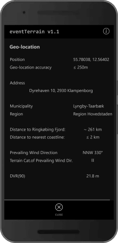
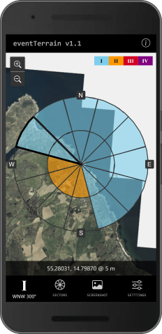
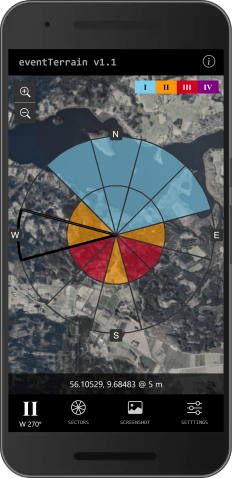
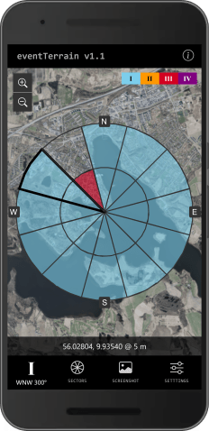
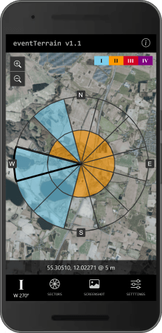
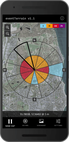
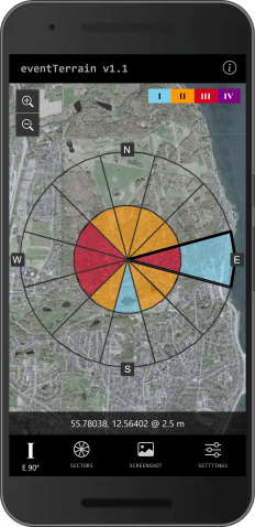
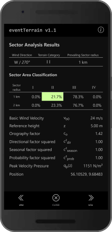
Workflow
eventTerrain turns on-site location data into a consistent, Eurocode-aligned exposure assessment - helping teams make faster, more defensible planning decisions for temporary structures.
Start assessment instantly on-site, using the QR code or your mobile browser.
Get an automated, location-specific assessment of the surrounding terrain, elevation effects, and exposure using applicable national parameters.
Apply a consistent exposure basis for ballast, anchoring, and layout decisions.
Features
eventTerrain combines geospatial data and Eurocode-compliant logic in a lightweight mobile workflow — reducing manual assessment work while improving consistency across sites.

Assess the actual site location instead of relying on regional assumptions or generalized exposure estimates.

Uses Eurocode-compliant calculations and applicable National Annex parameters for supported countries.

Built entirely on open datasets from national agencies and EU sources.

Runs in-browser with no access to personal device data.
Use cases
eventTerrain provides a consistent, defensible basis for exposure assessment without slowing planning or on-site operations.
Move quickly from site inquiry to exposure assessment and set clearer expectations across varying site conditions.
Support customer planning discussions with a consistent, site-specific exposure assessment.
Start ballast and anchoring reviews from a transparent and consistent exposure basis.
FAQ
eventTerrain is designed for fast access in the field, but results should always be reviewed as part of a professional engineering and planning process.
Event professionals, staging suppliers, temporary-structure engineers, and operations teams that need fast, consistent terrain-category assessments for planning and review.
Helping teams reduce guesswork, improve consistency, and make faster on-site decisions.
eventTerrain runs directly in the mobile browser — no installation or login required.
Access is currently free for field use, and the tool is designed for fast, on-site assessments without setup time.
A GPS-enabled device with location services and an active internet connection is required. Data charges may apply.
No. eventTerrain supports consistent, data-driven assessment workflows. Engineering responsibility, approvals, and final design decisions remain with qualified professionals.
It helps determine terrain category and site-specific wind exposure parameters for temporary structures such as tents and stages.
The result provides a consistent exposure basis for planning, quoting, and safety review
eventTerrain currently supports: Denmark.
Sweden and Norway are available for beta-testing for select users.
Support is expanded based on data quality, regulatory alignment, and field-testing feedback.
eventTerrain performs Eurocode-compliant calculations and automatically applies the relevant National Annex for each supported country.
This ensures that exposure assessments follow the same rules engineers and reviewers rely on in formal documentation.
eventTerrain does not collect personal information or access unnecessary device data.
Your assessment activity remains private and under your control.
Get Started
Open eventTerrain on mobile to assess site exposure and bring consistent terrain-category inputs into temporary-structure planning.
